
paragliding specific feature request
Bug #528671 reported by
Ulisse
This bug affects 1 person
| Affects | Status | Importance | Assigned to | Milestone | |
|---|---|---|---|---|---|
| gpxviewer |
Fix Committed
|
Medium
|
Qball Cow | ||
Bug Description
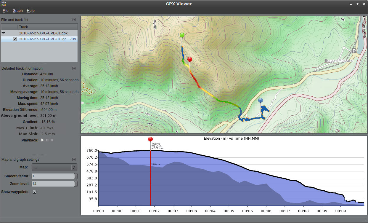
Some features could make this application really useful for paragliding route tracking:
- It would be really nice to have max/min/average values for both positive and negative vertical speeds (and maybe a specific graph too)
- if feasible, the track could be coloured according to the climb ratio, i.e. blue when descending and red when rising.
- if available in map sources, the actual terrain elevation could be displayed together with track elevation, to show the pilot's height above the land.
first two features could be useful also in other uses i guess, like biking or mountain running.

| Changed in gpx-viewer: | |
| status: | Confirmed → In Progress |
| Changed in gpx-viewer: | |
| milestone: | none → 0.3.0 |
| status: | In Progress → Fix Committed |
To post a comment you must log in.
Can I get example GPS files and mockup?